Taking the Aire

A walk from the Woolly Sheep Inn, Skipton | 9¼ miles

Skipton is, of course, the gateway to the Yorkshire Dales. But head in the opposite direction and you enter a scenic region on the banks of the Aire which is every bit as appealing as the famous National Park to the north but has a fraction of the visitors.

On top of that, on this route you won’t need your car as you can walk from the door of the Woolly Sheep Inn.

view interactive MAP

download leaflet

Directions

Turn right out of the Woolly Sheep Inn then right down Swadford Street, cross Belmont Bridge and turn immediately right down Belmont Wharf to join the canal towpath and keep heading in the same direction.

At the second swingbridge leave the towpath and turn left then, before the main road, right to pass Magnet and Kwik Fit. The road dog legs left over the railway after which turn right down Engine Shed Lane.

1

At the end bear left heading through an underpass below the A629. Cross a stone stile and continue beside a wall on your left. Cross a second stile and head towards and over a green metal footbridge. Cross a third stile and head towards the chimney of Carleton mill.

Go through a wooden gate and over a stile and keep ahead in the same direction on a lane into the village. At a junction turn right onto Beckside.

Follow the road as it bears left beside a brook. At a T-junction turn left to pass the mill and village store. Keep ahead on West Rd to leave the village.

2

Pass Carla Beck Farm and a public footpath fingerpost. Yards after that turn right up a stony track with barn to the left. At the back of the barn look across the track for some stone steps cut into a bank almost directly in front. Go up the steps to begin crossing a field.

Cross a stile then head in a 10 o’clock direction heading just to the right of the second electricity pole from the left. Cross a stile about 20 yards from the wood to your right. Head across the next field heading for a point to the left of the next electricity pole. Cross a stone stile then, immediately, a stile over a fence.

Turn right onto the Tarmac drive. Just before the gates to Carleton Biggin Farm turn right down a signed footpath which dog legs to the left and takes you over a stile and through a double wooden gate and another gate.

Begin the ascent of Burnt Hill keeping the wall to your left throughout. Where the path kinks briefly to the right ignore the aluminium gate and keep ahead. Cross a stile and head towards and through conifers.

3

Eventually you reach a second aluminium gate. Pass through it and descend towards Peat Gill Head farmhouse within some trees along an easy-to-miss track. (Look out for a post with yellow dot).

Cross a stone stile (also with yellow dot), pass through a gap in a tumbled down wall and continue towards the farmhouse. Pass through an aluminium gate and to the right of the farmhouse and, as the track bears left, look for a post with yellow top.

Bear right at that point keeping parallel with the track. As you approach the next house bear left and up slightly in the corner of the field to join the track.

4

At the road turn left then soon right down a signed footpath. Head for an ungated gap in the wall and descend towards a thicket enclosed by a curved wall. On the left side of the wall look for a stone stile which takes you into a wooded hollow.

Bearing slightly left emerge from the hollow and turn right onto a grassy then gravel track. As you descend fork left down an easy-to-miss footpath. (The sign is only knee-high and covered in summer).

You will have an old down wall on your left and steep bank to your right. Cross a stile and pass garages to reach Cononley.

5

At the road turn right then second left down Main Street to the New Inn. Immediately after the New Inn turn left down New Inn Fold.

At T-junction turn left and soon right down Meadowcroft. Head down a footpath to the left of house no 28. Pass through a metal gate and proceed down a field, thorough a gate with sun ray pattern then turn left (not past the allotments) and go through a gap in the wall.

Cross a stile to reach a broad, stony track. Turn right, cross the railway line and continue along the track as it bears left and eventually peters out to become a footpath beside the River Aire.

Keep beside the river, following the path through some gates and under a green, iron rail bridge. Pass a stone culvert and head to the right of electricity lines and an embankment across fields heading towards the more distant of two road bridges. (The public right of way isn’t apparent.)

6

In the corner of the field cross a stile and, at the road, turn right and over Carleton Bridge, under the A629 and past a crematorium.

Turn right down Burnside Crescent then left down Burnside Avenue (later ignoring the sign for ‘Burnside Crescent, nos 57-68’).

Pass a school then cross a footbridge over the railway. At the Champions Church turn right and over a rail bridge then turn right onto the A6131. After 100 yards turn left across the hospital car park and join the canal towpath via a railed path.

Turn left at the canal towards the town centre. Just after a large church on the left cross the Gallows footbridge over the canal and pass through the bus station.

Turn left at main road to return to the Woolly Sheep Inn.

The walk in short

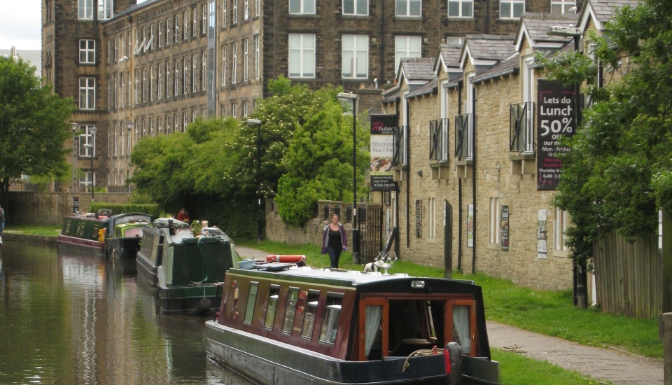
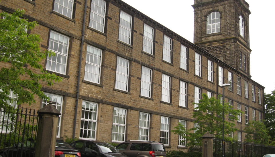
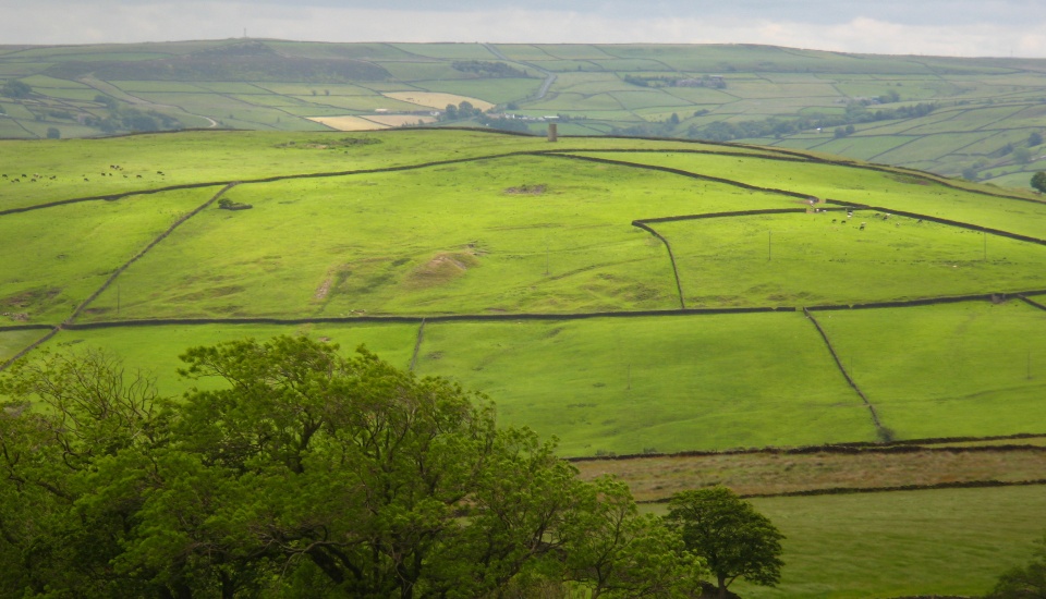
The route has bags of variety – from the canal towpaths in Skipton to the high moorland near Carleton in Craven which boast panoramic views back over Skipton and towards the riverbank of the Aire which provides your gentle return.

What's the walking like?

The full route is 9¼ miles and you need to allow a day for it but you can reduce the distance by using public transport. Some of the paths are overgrown in summer and a little difficult to spot so don’t go long without checking the directions.

The route will be muddy after rain. The only climb is up Burnt Hill but it is not arduous or lengthy. There are numerous stone stiles set into drystone walls.

What are the best bits?

Measuring 123 miles the Leeds & Liverpool canal is the longest man-made waterway in Britain. It was the main trade and communication link with the outside world for Yorkshire, Lancashire, Greater Manchester and Merseyside making the Irish and North Seas connect with the national network of inland waterways.

The village of Carlton in Craven is dominated by an old cotton mill which dates back to 1861. The old workers’ cottages line the Beckside crescent. The mill housed a mail-order business throughout the 1930s and was used by Rover to produce aircraft parts in the Second World War. Thereafter the mill was a textile factory again, later producing carpets. It closed in 1999 and has since been converted into apartments.

Owned by the Duke of Devonshire, the Cononley Lead Mine was established around 1810 but most of the lead had been exhausted by the 1860s. During operation the mine boosted the population of Cononley to more than 1,500. From the walk route you get a fine view of the mine chimney on top of The Gib Hill.

Shorter options using public transport

Train: You can roughly halve the distance by catching the train from Cononley back to Skipton. There are about four services an hour and the journey time is eight minutes. To find Cononley station walk past the New Inn and continue on Main Street to the eastern fringe of the village.

Walk distance using train: 5½ miles.

Bus: A bus service (no 12) operates from stand 1 of Skipton bus station to Carleton on weekdays only. There are five services a day and the journey time is about seven minutes.

Alight at Carleton and follow the directions starting with the loop around the village. Towards the end of the route just before Carlton Bridge follow the signs along the road to Carleton for a return bus if timetables allow.

Walk distance using bus: 6½ miles.

Discover more of our bespoke walking routes and bike rides

timothy taylor's pub walks & bike rides

Timed popup